[bikemap 1945827]
At last, after much preparation and testing, an actual adventure to embark upon! An overnight trip, ostensibly to test out the practicality of wild camping. A chance for a decent long walk and to explore some of the local countryside. The objective – walk from home to the Quantock Hills, camp overnight, and then walk back the following day. Figure out where to pick up food and water on the way, how to avoid unpleasant encounters with people or other ‘wild’ critters, and try not to come back too smelly.
It’s about 10 miles in a straight line from home to the Quantocks, so I knew I’d be in for a slightly longer walk because no matter how hard you try, you can’t quite devise a straight line route from A to B. Even with a reasonable footpath network around here, you still have to go around the houses (sometimes quite literally).
I even had to set the alarm to ensure a decent start time, but it was still about 10am by the time I was breakfasted, packed and ready to go. Mel sent me off with the best of wishes, or at least I think that’s what she said!

Between Langley and Ford I came across my first encounter with the wildlife. The first field I entered the sheep took an intense interest in me, probably because the farmer hadn’t yet got around with some feed that morning and so they thought that my back pack might contain something worth mugging for. There were more sheep in the field than the picture shows, but this pack quickly grouped together and then started following closely behind. Not much in the way of menace though, and they broke off shortly after when they realised they weren’t going to get fed.

Looking back towards Wiveliscombe
A brief glimpse of Wiveliscombe as I climbed out of Ford heading off towards Fitzhead. The destination for the first half of the day would be Bishops Lydeard, as its about the only place on route to the Quantocks that has a pub that’s open weekday lunchtimes, and a shop to pick up provisions for supper and breakfast. I had a few snacks stashed in the bag in case I got caught out, but not really enough to have satisfied me for the duration of the trip. I also deliberately took a route I’d not been before, a footpath that leaves just on the northern edge of Ford and heads across the fields along a ridge to Fitzhead.
")
The First Field of Elephant Grass (Miscanthus)
There is a stereotypical view of English fields – swathes of green pasture, or neatly ploughed arable, but no soon had I broken out of the woods was I presented with a view, or more a wall, of Miscanthus, a.k.a Elephant Grass. At least I hoped there weren’t going to be elephants in this lot, although someone had kindly cleared a sizeable path through it. Interesting stuff, and reminds me of a Stephen King novel about the children of the corn. Fortunately I passed through it without seeing any axe wielding tikes.
The remainder of the walk to Fitzhead was as to be expected – green pastures and plenty of mud. More of a squelch than a walk, even on the top of a hill, the persistent rain of the last year has yet to roll off down the hill and into the sea.

Interesting Ironwork in Fitzhead
One thing I noticed as I crossed the fields to Fitzhead was the range of gate fixings on offer. Plenty of the modern alloy variety, but quite a few interesting wrought iron pieces still putting in good service. It’s lovely to see this sort of thing, and think of the people who made it so many years ago, and the people who have handled it in the years since. If inanimate objects could speak, I’m sure they’d have some interesting tales to tell – family fun, wet walkers, trysts and arguments. Probably more interesting than this little tale.
The piece pictured was actually a handrail to steps leading up to the church yard. The fact that someone when installing this lord knows how many years ago had taken the time to create a neat finish and practical handle was an interesting to compare with more modern attempts in the name of health and safety which might tick the boxes but seriously lack and soul or empathy with the user.
Through a particularly untidy and muddy farmyard, and across fields I slightly lost my way in a field with rows of what looked like raspberry canes, but were almost certainly something else although I was unable to say quite what. Definitely some sort of small, soft fruit. Despite not being able to figure quite where the path led, and being presented with no-right-of-way signs, I had to skirt around the edge of the field knowing that I wasn’t far enough down, and hoping that there would be a gateway somewhere to lead me in the right direction. I was trying to avoid using the iPhone maps/GPS for navigation, preferring to read the printed maps and figure out where I was based on a landmarks and topography. Using only a 50,000:1 scale map meant that field boundaries are not shown, and you have to figure it out from roads, settlements and contour lines. A useful skill, if you have it. I was sure I was in the wrong place, so double checked with the iPhone, which was happy to confirm my suspicions. Still, I found another exit from the field and was able to get back on track quite quickly, but it was an interested first test in navigation (I hasten to add that I have done some orienteering in the past, but its not a strong skill so one worthy of a little extra practice!)

Marker Post on Ash Common
Successfully finding my way again, I had to negotiate some particularly boggy ground and across a stream. Great bridge, but the bog either side made for interesting going. Once out of the quagmire, I was quickly onto firmer ground in the shape of Ash Common. I’ve always liked Ash Common, it reminds me I think of where I grew up in Chobham, Surrey, which had a similar patch of green that linked to the surrounding common land and was often the scene of misspent youth. There were chainsaw noises coming from the surrounding woodland, and there was evidence of scrub clearance. Once I set off again, there was a collection of Western Power vans marked with ‘tree surgeon’ and I could make out the flash of orange hard hat through the trees. I couldn’t see that they were clearing beneath power lines, so really not quite sure why they were clearing parts of the common, but I guess someones got to do it.

Bishops Lydeard Railway Station on the West Somerset Steam Railway
Heading off along the road in the direction of Bishops Lydeard, you cross over the railway line which is the West Somerset Steam Railway, a suitable little blast from the past and a far departure from type of station that you now encounter on the main line. Whilst the line is connected to Taunton and beyond, its not normal for any trains to link to main line services, other than the occasional special. But Bishops Lydeard is the first station and from there you can take a nostalgic jaunt along the track to Minehead.

'Fives Wall' at the Lethbridge Arms, Bishops Lydeard - This is the back side, the other side is the playing side
Arriving in Bishops Lydeard I arrived at the very welcome Lethbridge Arms. I think its had a troubled recent history and has been closed on occasions, but it appears to be smartly updated and doing a good trade at the moment. When we came here the previous day by bikes, I was intrigued be the huge wall in the car park and was interested to find out what it was. After taking a well earned and leisurely lunch of imaginative sausage and mash, and a lovely pint of ale, I asked the barman if he could shed any light. The casual observer would think its the gable wall of some old, oversized barn or perhaps warehouse, but I couldn’t figure out where the remainder of the building had disappeared to, as it just stands there, unconnected to anything else.
The barman set me straight – its a [Fives Wall](http://www.wessex.me.uk/Fives/fives.html). This is a game that looks a little bit like Squash, but it played with a gloved hand. The wall itself is constructed to look a bit like the buttressed tower of a church, and the origins of the game does come from a time when it was played against church buildings, presumably until such time that the church decided that it didn’t want its stained glass windows broken anymore, and so someone decided to build a dedicated wall to play against. The ledges, holes and angles all seem to add to the randomness of the game. Apparently people still play against this wall at least once a year, and there are other walls around the country so its not just a historical artefact.
With lunch settling nicely, I wandered on to the Co-op and stocked up on supper and snacks for the afternoon and evening ahead. I managed to miss the path I’d intended to walk, and continued on up the road towards Cothelstone, but then veered off to the east before picking up another footpath heading slowly up towards the Quantocks.

Miscanthus - Motorways for Deer
I was again presented with a vast swathe of Miscanthus, with a wide stripe left for the footpath through the middle of it. In the muddy ground there were huge numbers of deer tracks. I’m guessing the love it for shelter and a place to hide, although I couldn’t see any evidence of them pushing into the long grass, but they’d definitely been here recently, and in places there were so many tracks that I couldn’t count the numbers that might have been here. I was expecting at any moment to be mown down by a charging hoard, but alas there were none to be seen today.

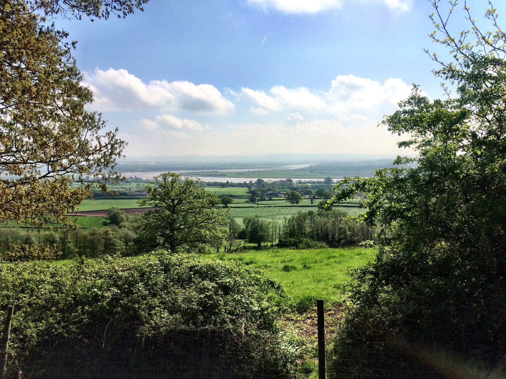
Far Reaching Views Across Taunton Vale
At the end of the path where it rejoined a small lane, there was a large house, with fine views back across Taunton Vale. This place, although obviously based on the site of an older farm, was rather plush, with outside swimming pool under a retractable greenhouse arrangement. Through the windows of the expansive conservatory I could see what might have been the biggest TV set on the planet. It looked like they’d borrowed it from Times Square.
I’d now got to the hard part of the walk, the main climb up onto Cothelstone Hill. I’d opted for a sweeping approach, along a Restricted Byway that curved its way up onto the hill in the hope that this wouldn’t be quite so hard work as the full-frontal assault. I’m sure it was easier, but it was still a bit of a slog, and because it was a tree-lined lane, I didn’t get quite the views that I’d hoped for, other than fleeting ones as I passed field gates. Eventually I came out of the trees onto the top of the hill, and headed on up to the pile of stones that marks the summit, and then walked out towards the west where there is an area fenced off around a couple of [Tumuli](http://en.wikipedia.org/wiki/Tumulus#Britain).
This provided a nice spot, a view off to the south and the bright lights of Taunton, and out west over the Vale of Taunton Deane. I waited for a few minutes as the light faded and the dog walkers disappeared, and then broke out the tent and set up camp for the evening.
For those not familiar with the concept of wild-camping, then basically you should understand that in England and Wales, you have no specific right to camp. This is because most land is privately owned, and where there are footpaths or other byways, you only have a ‘right of way’, and not a right to stop and set up home, even for a short period. As far as the Quantocks are concerned, this falls under park authority rules which also specify no camping. Basically, if you choose to wild camp, you have to accept that someone might move you on, and in the worst case, bring a civil proceeding against you, effectively for trespass. That seems only likely if you stray onto land which is particularly sensitive, and the general consensus amongst those that wild-camp is that you should arrive late, leave early and leave no trace. No sitting around in deck chairs cracking open the beers during daylight hours, you’ll only get people pissed off. Obviously if you want to be undisturbed, then you are best to avoid humanity, livestock and places where dogs and the like are prone to roam, as they’ll all take interest in you.
As for my spot on the Quantocks, I was purposely being bold. I had considered finding a wooded spot out of view and away from the main tracks, but you don’t get the views that make the experience worth having. Also, there’s the chance that a dog will discover you and not leave, meaning the owner ends up having to come and retrieve them, which is bound to cause aggravation, especially if the dog owner is out hunting. So I choose a spot as far from the main area around the summit as possible, with a reasonably flat bit of ground. Chances were that the only trouble might be from the hill ponies that are free to roam, and I’d passed some of them only half a mile away.
As it was, I was settled down and fed for the night by 9:30pm when, lying in the tent but with the door open a large torch illuminated the surrounding trees. I thought this might be someone hunting, or possibly a ranger who’d either already spotted me, been told about me, or was just coming to check on the off-chance. I poked my head out of the tent and saw that they had dogs, and as they got closer, I poked my head out again and saw two Dobermans looking at me. At the same point, the owner spotted the tent and me, quietly called the dogs away and continued on their way, which was effectively back the way they came. So, no fuss or nonsense.
The rest of the night was peaceful and pleasantly warm, although I was in the sleeping bag with most of my warm clothes on, but given that it was forecast to be around 7-8 deg C overnight, there was little chance of a cold one. I woke at about 6pm, whilst it was still dark, and needed to get up for a leak, and as I got out of the tent there was the clatter and scattering of hooves as several ponies shot off in all directions. Whilst I had my head torch on, it was not powerful enough to illuminate anything more than a few feet away, and so whilst I didn’t see the ponies, they’d obviously quietly sidled up during the night and I’d spooked them away. Hope they didn’t mind too much.

First Light WIld Camping on the Quantocks
I breakfasted and as the sun finally started to rise around 8am, I started to pack away. The first of the dog walkers arrived and I had a nice chat with her, although she told me that the ponies at this end of the Quantocks tended to be a bit vicious, having kicked one of her dogs a few days before. Glad I’d not got kicked when they scarpered!
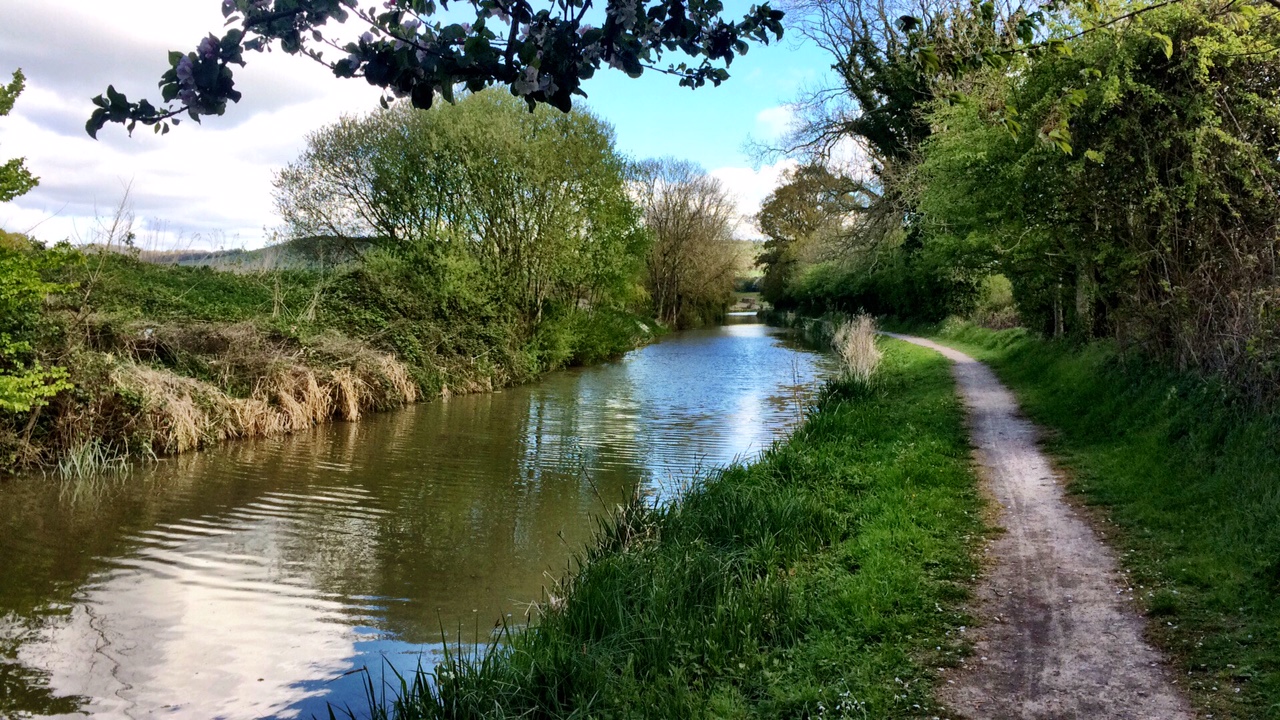
Now for the return journey home. I wanted to avoid walking back the same way that I came, and also wanted to try and find somewhere for lunch, but the options are not great, especially on a weekday. The only certain choice for food was going to be back through Bishops Lydeard, but it wouldn’t take make long to get there, and whilst the Co-op would be open it would be too early for the pubs. So I headed north off of Cothelstone Hill and headed down in the direction of West Bagborough. I knew going this way that I’d be hard pressed to find even a shop, but there was a chance of a pub or two.

Idylic Pasture above West Bagborough
After the descent off the hill, my map suggested that I’d have to walk the roads down into Bagborough, but just after joining the road I found a footpath sign, not marked on my 50:1 map. I decided to take it, as it would one way or another drop me down in the right direction. I wandered through the woods for 15 minutes or so, then came out into a field that was just idyllic to look upon. A large field dotted with mature trees, fat wooly sheep and an impressive view out across the Vale of Taunton. Put me in mind of Wordsworth who stayed in these parts one (along with Samuel Taylor Coleridge, and hence the Coleridge Way that crossed the Quantocks and Exmoor from Nether Stowey to Porlock).

Spring Lambs above West Bagborough
I had to imagine quite where the footpath went, as still no clue on the map, but there was a well worn dent in the hill side which at one time would have been a well worn track, but now grassed over. I followed this and then have to climb over a gate to get out of the field and back onto the road, which led me down to West Bagborough.
There was life in the Rising Sun pub, but sadly only the cleaners, and it was still before 9am, so I had to settle for a cheery hello to a couple of dog walkers who’d stopped outside the pub for a natter. I then decided that I could head for Coombe Florey, which would help to vary the walk home, but by this time I was pretty resigned to not getting a lunch anywhere. Fortunately I’d stocked up more food than needed, so would have a snack or two to tide me over. I would need to get a water refill somewhere, as I’d used the last over breakfast.
After only one field, occupied by some very inquisitive sheep who damn near chased me from it, I was back out onto the lanes again, which I’d have to stick to until I met the A358 at Coombe Florey. I stopped for a while for chat with an old boy who was out trying to make the most of his vegetable garden. We both complained at the state of the weather and the chance of being able to grow anything, and he enquired if I’d been camping and then reminisced about when he used to go camping on the Quantocks, although never managed to persuade the wife to join him.
I tipped out onto the A358 just short of Coombe Florey and had no choice but to walk along the main road for about half a mile to the turning, including going under the railway bridge. Fortunately the traffic was light, and not a single lorry passed. Most of the way the verge is wide, but I walked on the shoulder. It constantly amazes me how motorists think that its acceptable to pass within inches of someone either walking or cycling. When walking, at least you can look them in the whites of the eyes, and step aside if they don’t appear to make eye contact, which some of the don’t as they are too busy fiddling with their mobiles.
Before crossing into Coombe Florey, I nipped into a dilapidated bus shelter, hoping for a sit down, remove my jacket as it was now starting to warm up, and have a quick snack. Alas, no seat, and going by the graffiti it had been used on more than one occasion as an overnight doss for someone, either homeless or travelling. There was one that had a date from some years earlier, and the simple message ‘stopped the night and had the shits’. Charming! I hope he went outside when nature called.

Main House in Coombe Florey
Coombe Florey is a charming little village, with a stout gatehouse that seemed to lead up to the big house on the hill, sitting next to the village church. I opted for a footpath cutting out across the fields, passing by the graveyard. I noticed here again that there were some lovely old gates and ironwork that have survived simplistic modernisation, perhaps because someone on the parish council is clever enough to do a good job of mending rather than just contracting someone to come and replace things when worn. Or perhaps these places are just sleepy enough, or only visited by car users, that the footpaths get little used and therefore the fixtures become little worn. I’m curious to know why some places seem timeless, and others are not.

Rustic Gateway in Coombe Florey
The footpath took me out across fields with views of Bishop Lydeard church poking up from the vale to my left and the ground gradually rising up to my right. I passed close to a place by the name of Sandhill Park, which I didn’t even know existed. The map marks it as a former hospital, and the first building I could see was derelict. There were much large houses, one looking impressive in size but definitely old and faded, and a even larger house that was completely wrapped in scaffolding and plastic, either to keep the elements out or because work was actively in progress to renovate it. From the map it looks like the former grounds have started to be developed for housing, although I couldn’t see any from my vantage point. It would once have been a grand manor with landscaped parkland surrounding, and its always sad to see these former glories decaying, and then being destroyed by housing developments. Despite the apparent concentration of wealth, no-one these days seems to want to spend it on quality, lasting, bricks and mortar.
I ended up joining up with my outbound route, which was a shame, but there is a bit of a dearth of footpaths around Fitzhead and Halse, so it was somewhat inevitable. I had the chance of heading into Halse to see if the New Inn would be open, but on a Tuesday lunchtime I thought it a risk, and checked their website and indeed confirmed that they were shut. That meant there was no chance of a pub lunch without a major detour. I was starting to flag and could really do with a nice sit down, a pint of beer and a hot lunch. Must remember to plan better next time. I was also getting hellishly thirsty, and as I walked up a track to connect to a footpath, I passed through a farm and there was a lady emptying bins. She was very happy to refill my water bottles, and we went around to the stable yard to find a tap. The farrier was just finishing up attending to the small collection of horses and ponies, and several dogs scampered around and being friendly. I saw one eating the horse shit and decided not to get too friendly, and busied myself with refilling the bottles whilst the lady said goodbye to the farrier.
Having kept horses in the past, it was nice to have a chat about her horses and our former ones. She had a chestnut mare that looked very similar to ours that we only finally parted company with last year. We stood there in the yard talking for perhaps 10-15 minutes, and then she was kind enough to point me in the direction of the footpath that led towards home.

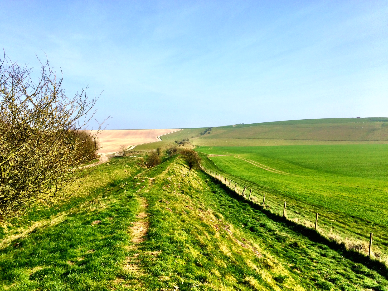
Looking Across Fields Towards Oakhampton Quarry and Home as Rain Approaches and Visibility Drops
No with the thirsty quenched, stopping for a snack was going to be a priority, and eventually I was walking through fields and crested a hill to be presented with a nice view across towards Oakhampton Quarry. I could see the visibility starting to drop in the distance, and expected the rain to arrive within half an hour, so sat down on the edge of the hill and had a quick and impromptu ham sandwich, a bit of chocolate and more water. That certainly pepped me up, and as the visibility dropped further I decided to don the waterproofs so I wouldn’t have to struggle with them in the middle of a muddy track somewhere.
In the end, the rain held off. Although the visibility continued to drop, it was more mist than anything else, and it wouldn’t be until within 5 minutes of home that it actually started to drizzle. After another 20 minutes or so of walking I stopped to admire the view across the fields towards Wivey and stripped off the jacket which was starting to turn into a steam cooker. I left the waterproof trousers which were performing much better, just in case.

Views of Maundown and Wiveliscombe Across the Fields
Finally back at home, arriving quite early at about 2pm, but that was to be expected given the lack of a suitable lunch stop to rest and recuperate. As a result of the lack of both sufficient energy and water, I was pretty cream-crackered by the time I got back, and all I could do was strip off and then sit in the bath for half an hour. Once cleansed, I couldn’t muster any more useful energy and so sat of the sofa for the remainder of the afternoon, reading a very silly book ([Free Country: A Penniless Adventure the Length of Britain](http://www.amazon.co.uk/Free-Country-Penniless-Adventure-ebook/dp/B0085W00M8)) about two chaps who set about cycling from Lands End to John O’Groats, but without spending any money. To give you an idea, they set off from Lands End wearing only a pair of Union Jack boxer shorts each, and had to rely on the kindness of strangers all the way for clothing, cycles, food and shelter. It’s a very funny read, restores your faith in humanity, and goes along way to show that too much preparation can be the undoing of many a great adventure. Just get out there and do it!